October 11, 2026 | Have You Heard? | Breaking Weather News
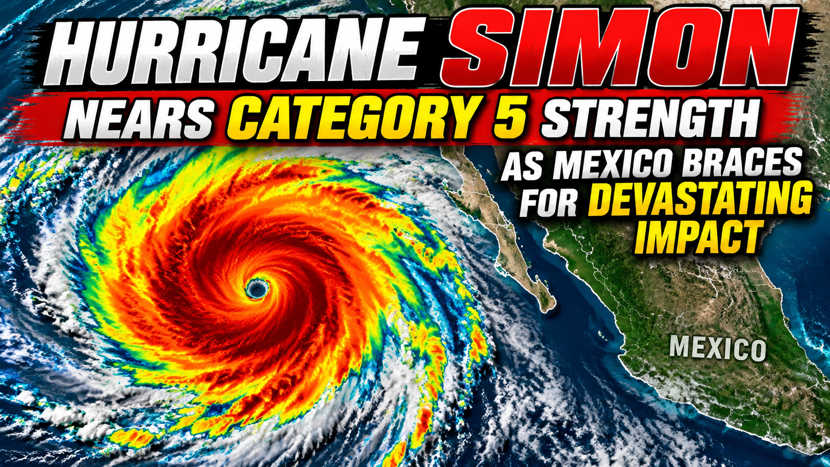
Hurricane Simon has become one of the most dangerous weather threats facing Mexico’s Pacific coast this October, reaching winds of 155 mph at its peak and approaching the threshold of Category 5 intensity.
As of the National Hurricane Center’s 9:00 a.m. Central Standard Time advisory on October 11, Simon remained an extremely dangerous Category 4 hurricane, with maximum sustained winds of 145 mph. Its center was approximately 65 miles west-northwest of Manzanillo, Mexico, moving north-northwest at 7 mph.
With the hurricane’s powerful core close to the coastline, forecasters warned of destructive winds, dangerous storm surge, extreme rainfall, and potentially life-threatening flooding and landslides.
Hurricane Simon Approaches Category 5 Strength
Simon intensified rapidly over the eastern Pacific Ocean, reaching maximum sustained winds of 155 mph before weakening slightly on October 11.
Category 5 hurricanes begin at sustained winds of 157 mph. Although Simon remained classified as Category 4, its peak intensity came remarkably close to that threshold.
Category 4 storms are capable of catastrophic damage. Their winds can destroy roofs, severely damage buildings, uproot trees, and leave entire communities without electricity or essential services.
Simon’s development demonstrates how quickly a tropical weather system can become a major hurricane when warm ocean waters, atmospheric moisture, and favorable wind conditions combine.
Mexico’s Pacific Coast Faces a Dangerous Threat
Communities along Mexico’s western coastline have been preparing for potentially devastating conditions as Simon approaches.
Areas of particular concern include coastal communities in Jalisco, Colima, and Michoacán, where the combination of hurricane-force winds, heavy rainfall, and hazardous seas could cause widespread disruption.
The National Hurricane Center issued hurricane warnings for threatened coastal areas, including the stretch from Punta San Telmo to El Roblito and the Islas Marías.
Officials in Jalisco suspended classes and began evacuations in 22 coastal municipalities. Businesses in Puerto Vallarta also prepared for the storm, with some boarding up windows and making arrangements to protect workers and visitors.
Tourism destinations, fishing communities, transportation routes, and coastal businesses are especially vulnerable when a powerful hurricane moves close to shore.
Extreme Rainfall Could Trigger Flooding and Mudslides
While Simon’s extraordinary winds have attracted attention, heavy rainfall may become one of the storm’s most dangerous consequences.
Forecasts have warned that rainfall totals could reach as much as 30 inches in isolated areas of western Mexico, particularly in mountainous regions of Michoacán, Colima, and Jalisco.
Such rainfall can overwhelm drainage systems, rapidly swell rivers, flood neighborhoods, and trigger destructive landslides.
Mexico’s mountainous terrain can make these hazards especially severe. Rainwater rushing down steep slopes may produce flash flooding even in communities located far from the hurricane’s center.
Flooding and landslides may continue after the strongest winds diminish, making it essential for residents to follow emergency instructions and avoid flooded roads.
NOAA Satellite Footage Captures Hurricane Simon’s Formation
Remarkable satellite footage from the National Oceanic and Atmospheric Administration (NOAA) and Colorado State University’s Cooperative Institute for Research in the Atmosphere (CIRA) offers a dramatic view of Simon’s development.
The October 9 satellite sequence shows intense thunderstorms organizing around the storm’s center as Simon developed into a hurricane.
The imagery uses enhanced infrared colors to reveal differences in cloud-top temperatures. These observations help meteorologists understand storm structure and monitor tropical cyclone development over remote ocean waters.
The footage documents Simon at an earlier stage of its development. It is not a live depiction of the storm’s October 11 intensity.
Watch the original satellite footage: Hurricane Simon — NOAA/CIRA Satellite Animation via Wikimedia Commons.
Why Rapid Hurricane Intensification Matters
One of the most challenging aspects of hurricane forecasting is the possibility of rapid intensification.
When ocean and atmospheric conditions are favorable, a tropical cyclone can gain strength in a relatively short period. That leaves coastal communities with less time to prepare for dangerous conditions.
Simon illustrates this danger. Its development from a tropical storm into a powerful Category 4 hurricane demonstrates why emergency planning must begin before the strongest winds arrive.
Even small changes in a hurricane’s path can significantly affect which communities experience the strongest winds, heaviest rainfall, and greatest coastal flooding.
What Happens Next for Hurricane Simon?
As of the October 11 morning advisory, Simon was moving north-northwest close to Mexico’s west-central coast. Its future track and intensity remain important factors in determining which communities face the greatest impacts.
Even if the hurricane weakens, dangerous rainfall, flooding, landslides, and coastal conditions could persist.
Residents and travelers in affected areas should monitor the latest National Hurricane Center bulletins and follow instructions issued by local emergency authorities.
The bottom line: Hurricane Simon reached winds just below Category 5 strength and remains an extremely dangerous hurricane near Mexico’s Pacific coastline. Its threat extends beyond wind damage to include severe flooding, destructive waves, and potentially deadly landslides.
Have You Heard? — Bringing you the stories behind the headlines.
Sources and Further Reading
- National Hurricane Center — Hurricane Simon Public Advisory, October 11, 2026, 9:00 a.m. CST
- NOAA NESDIS — Hurricane Simon Satellite Imagery and Storm History
- Associated Press — Hurricane Simon Threatens Mexico’s Pacific Coast
- Reuters — Hurricane Simon Near Mexico’s Pacific Coast
- Wikimedia Commons — Hurricane Simon Satellite Footage, October 9, 2026
Satellite footage credit: NOAA / CSU-CIRA, via Wikimedia Commons. Weather conditions are based on official reports available October 11, 2026, and may change as additional advisories are issued.